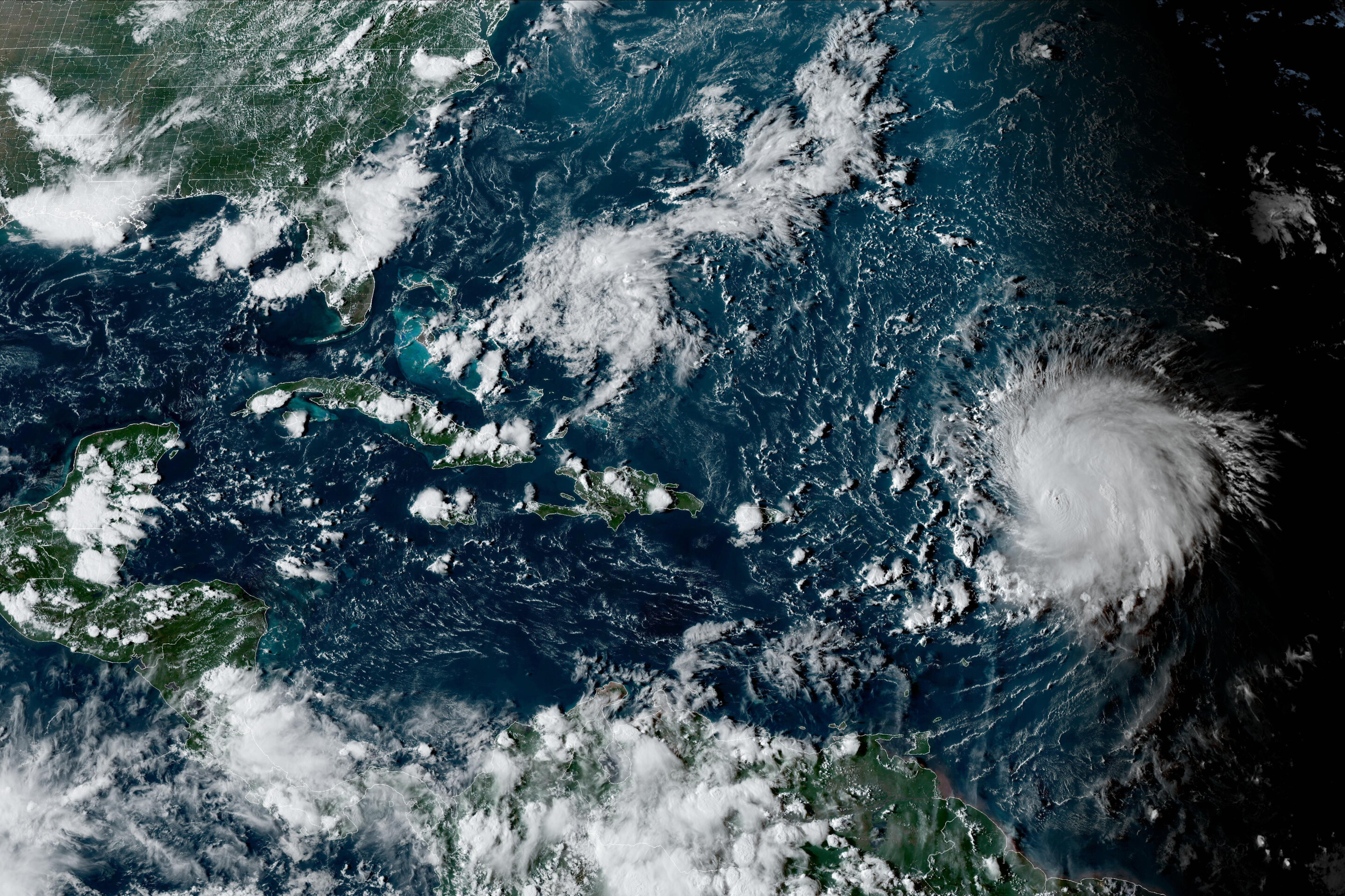
Hurricane Lee is rewriting old rules of meteorology, leaving experts astonished at how rapidly it grew into a goliath Category 5 hurricane.
Lee could also be a dreadful harbinger of what is to come as ocean temperatures climb, spawning fast-growing major hurricanes that could threaten communities farther north and farther inland, experts say.
“Hurricanes are getting stronger at higher latitudes,” said Marshall Shepherd, director of the University of Georgia’s Atmospheric Sciences Program and a past president of the American Meteorological Society. “If that trend continues, that brings into play places like Washington, D.C., New York and Boston.”
HYPER-INTENSIFICATION
As the oceans warm, they act as jet fuel for hurricanes.
“That extra heat comes back to manifest itself at some point, and one of the ways it does is through stronger hurricanes,” Shepherd said.
During the overnight hours on Thursday, Lee shattered the standard for what meteorologists call rapid intensification—when a hurricane’s sustained winds increase by 35 mph (56 kph) in 24 hours.
“This one increased by 80 mph (129 kph),” Shepherd said. “I can’t emphasize this enough—we used to have this metric of 35 mph, and here’s a storm that did twice that amount and we’re seeing that happen more frequently,” said Shepherd, who describes what happened with Lee as “hyper-intensification.”
With super-warm ocean temperatures and low wind shear, “all the stars were aligned for it to intensify rapidly,” said Kerry Emanuel, professor emeritus of atmospheric science at the Massachusetts Institute of Technology.

INLAND THREATS
Category 5 status—when sustained winds are at least 157 mph or 253 kph—is quite rare. Only about 4.5% of named storms in the Atlantic Ocean have grown to a Category 5 in the past decade, said Brian McNoldy, a scientist and hurricane researcher at the University of Miami.
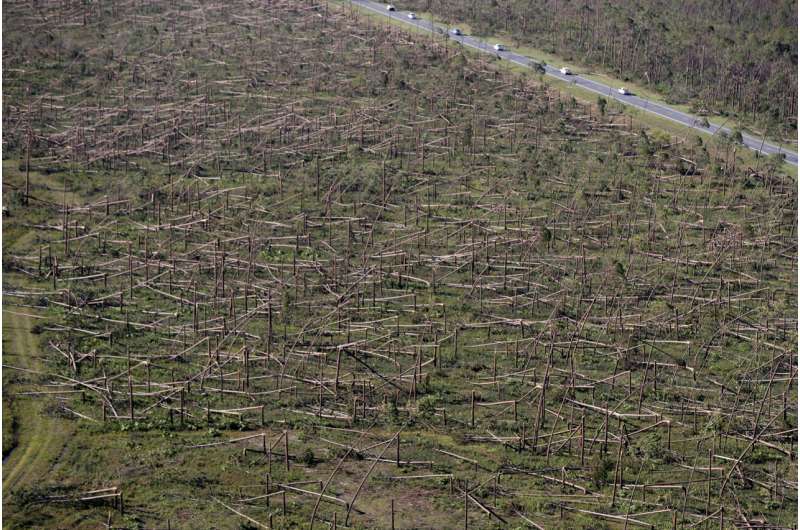
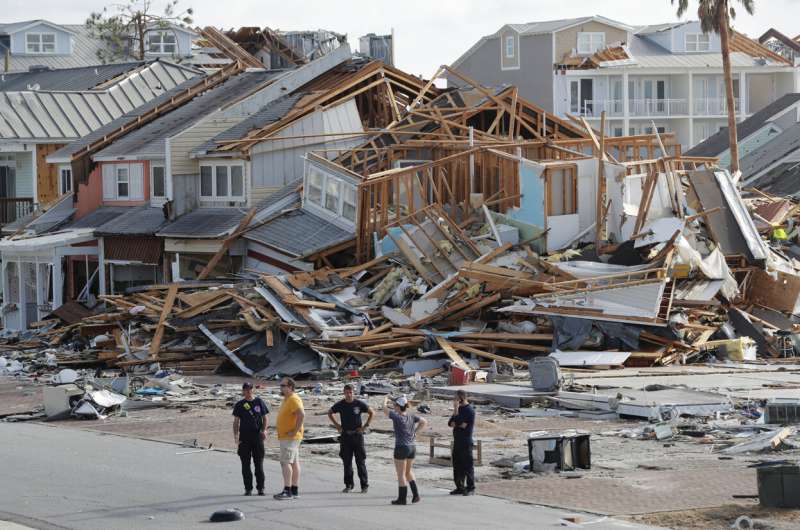
More intense major hurricanes are also threatening communities farther inland, since the monster storms can grow so powerful that they remain dangerous hurricanes for longer distances over land.
“I think that’s a story that’s kind of under-told,” Shepherd said. “As these storms are strong coming to landfall, in some cases they’re moving fast enough that they’re still hurricanes well inland.”
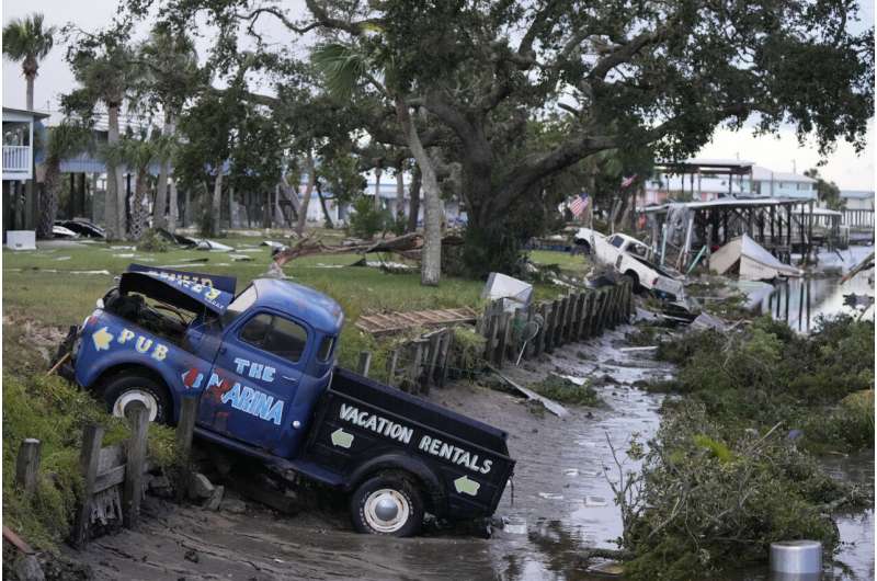
Hurricane Idalia was the latest example, when it came ashore in the Florida Panhandle last month and remained a hurricane as it entered south Georgia.
It then slammed into the Georgia city of Valdosta more than 70 miles (116 kilometers) away from where it made landfall. At least 80 homes in the Valdosta area were destroyed and hundreds of others damaged.
In 2018, Hurricane Michael carved a similar path of inland destruction, tearing up cotton crops and pecan trees and leaving widespread damage across south Georgia.

RISK FOR NEW ENGLAND
While it’s too early to know how close Lee might come to the U.S. East Coast, New Englanders are keeping a wary eye on the storm as some models have projected it tracking perilously close to New England—particularly Maine. It has been 69 years since a major hurricane made landfall in New England, McNoldy said.
On Sept. 8, 1869, a Category 3 hurricane known as “the September Gale of 1869” struck Rhode Island, the National Weather Service in Boston noted on Friday. The storm cut all telegraph lines between Boston and New York and capsized a schooner, killing 11 crew members.
“If Lee actually does make landfall in New England, there’s no doubt the storm surge would be a huge threat,” he said.
MONSTER WAVES
As Lee roils the ocean as it creeps closer to the eastern coast of the U.S., it could bring high seas and rip currents all up and down the eastern seaboard.
“What we are going to see from Lee—and we’re very confident—is it’s going to be a major wave producer,” Mike Brennan, director of the National Hurricane Center, said in a Friday briefing.
“This morning the highest significant wave height we were analyzing in Lee was between 45 and 50 feet, and the highest waves could even be double that,” Brennan said. “So we could be looking at 80, 90-foot waves associated with Lee.”

Emanuel was tracking the storm this weekend in New Harbor, Maine. Since it has been so long for any type of hurricane warning in New England, some residents might be complacent and think that hurricanes are a Florida or Louisiana problem, he said.
“One worries whether they’re going to take it seriously when it comes to that,” he said.
SOMETHING TO WATCH
Forecasters will be watching any possible interaction in coming days between Lee and newly formed Tropical Storm Margot, which is expected to become a hurricane next week.
It’s possible that Margot could alter Lee’s path, though it’s too soon to know whether that will happen, experts say.
Margot is far to the east of Lee, but as Margot strengthens it could affect the weather systems in the region that steer hurricanes.
A phenomenon known as the Fujiwhara Effect can occur when two tropical storms rotate around each other, but that doesn’t mean they will in this case, Emanuel said. If it does happen, though, the two storms could push each other around in the Atlantic, which could alter their paths.
© 2023 The Associated Press. All rights reserved. This material may not be published, broadcast, rewritten or redistributed without permission.
Citation:
Hurricane Lee is charting a new course in weather and could signal more monster storms (2023, September 9)
retrieved 9 September 2023
from https://phys.org/news/2023-09-hurricane-lee-weather-monster-storms.html
This document is subject to copyright. Apart from any fair dealing for the purpose of private study or research, no
part may be reproduced without the written permission. The content is provided for information purposes only.
Denial of responsibility! Samachar Central is an automatic aggregator of Global media. In each content, the hyperlink to the primary source is specified. All trademarks belong to their rightful owners, and all materials to their authors. For any complaint, please reach us at – [email protected]. We will take necessary action within 24 hours.

Shambhu Kumar is a science communicator, making complex scientific topics accessible to all. His articles explore breakthroughs in various scientific disciplines, from space exploration to cutting-edge research.


